


DJI Zenmuse L3 LiDAR Payload
Next-generation long-range LiDAR payload with dual high-resolution RGB imaging for precision mapping and surveying.
Zenmuse L3 integrates long-range LiDAR with high-resolution RGB mapping cameras and high-precision positioning system, delivering centimeter-level accuracy for surveying, infrastructure modeling, forestry analysis, and digital twin reconstruction.

High-Precision LiDAR Engine
1535nm LiDAR delivers dense point cloud generation with strong penetration capability.
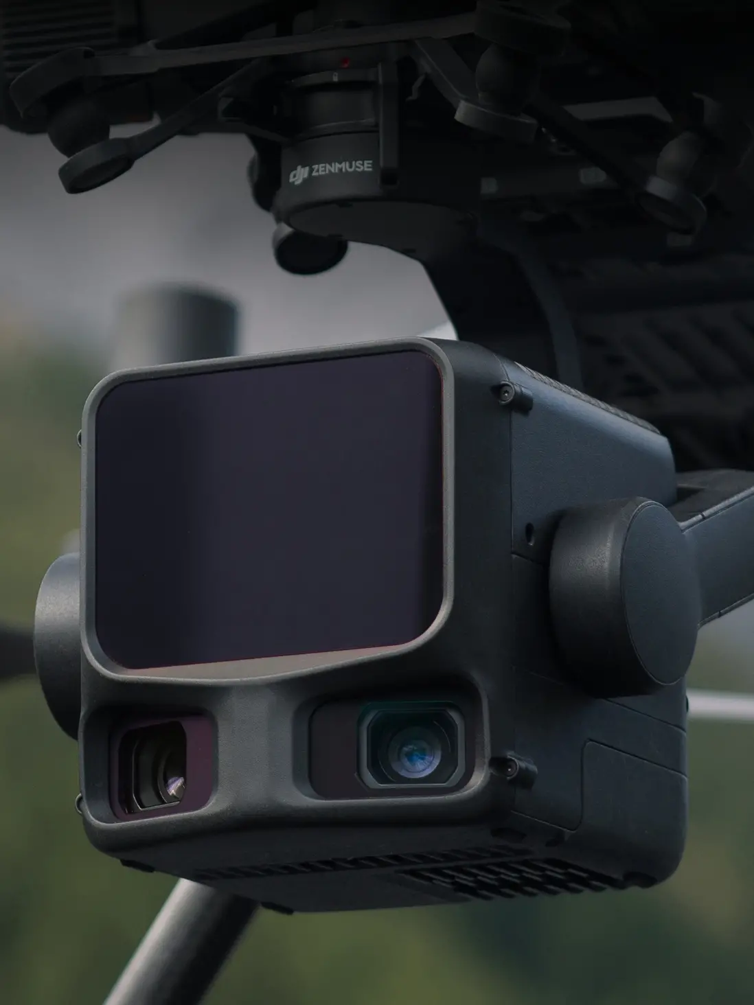
Dual RGB Mapping System
High-resolution RGB cameras enable accurate colorized 3D reconstruction.
Vegetation Penetration
Captures ground points beneath dense canopy for forestry and terrain analysis.
Built for Survey-Grade Accuracy
Designed for mission-critical geospatial applications including surveying, mining, forestry, and infrastructure modeling with centimeter-level precision.
| Capability | Enterprise Value |
|---|---|
| 1535nm Long-Range LiDAR | High penetration and long-distance scanning capability |
| High-Density Point Cloud | Accurate 3D terrain reconstruction |
| RGB + LiDAR Fusion | True-color digital twin generation |
| Centimeter-Level Accuracy | Survey-grade geospatial precision |
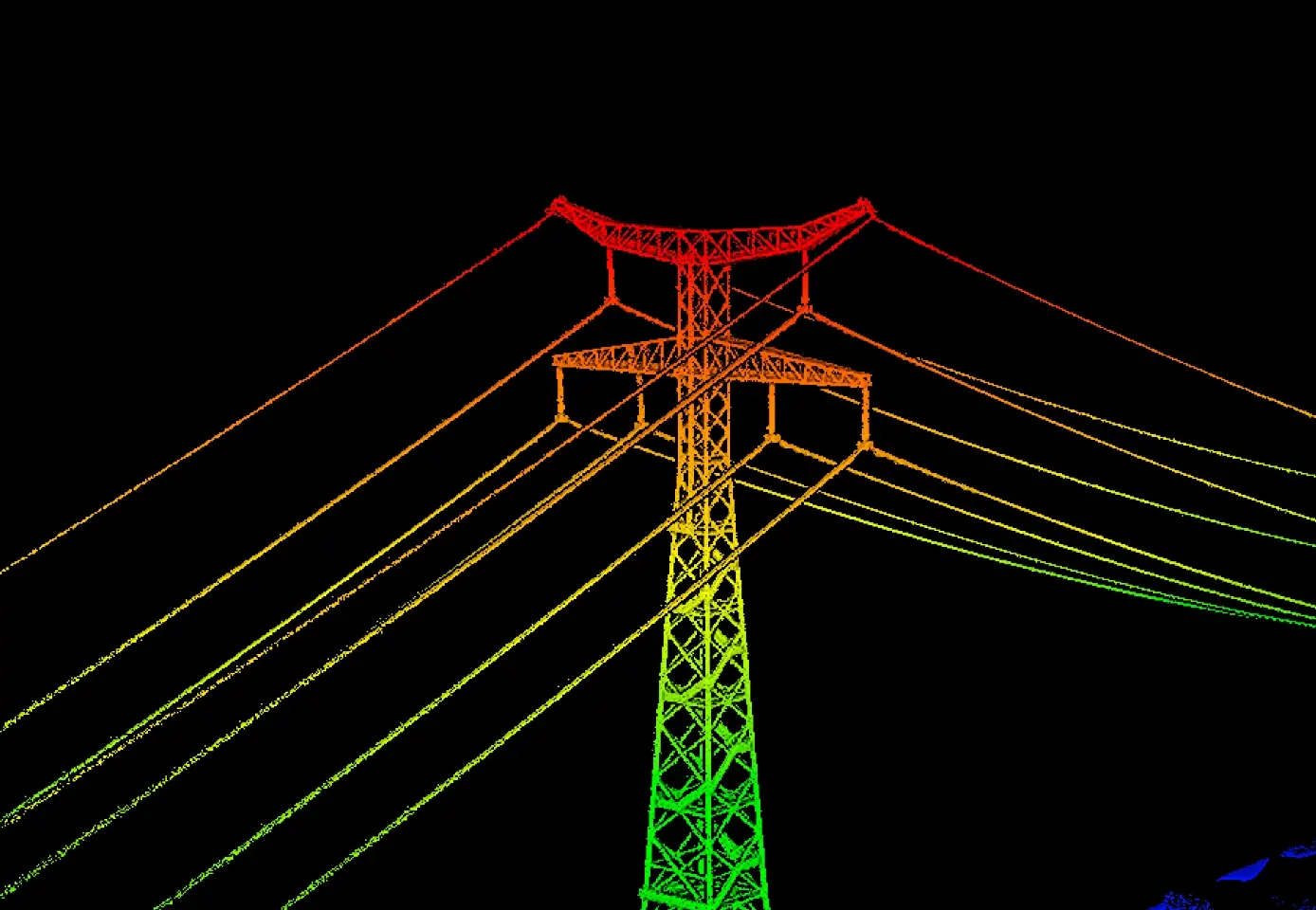
Power Utility Inspection
Efficiently inspect transmission lines, substations, and utility corridors with high-density LiDAR data. Generate precise 3D models to support vegetation management, asset monitoring, and infrastructure planning.

Mining & Stockpile Measurement
Generate high-precision 3D terrain models and calculate stockpile volumes, excavation quantities, and site elevation changes using dense LiDAR point cloud data.
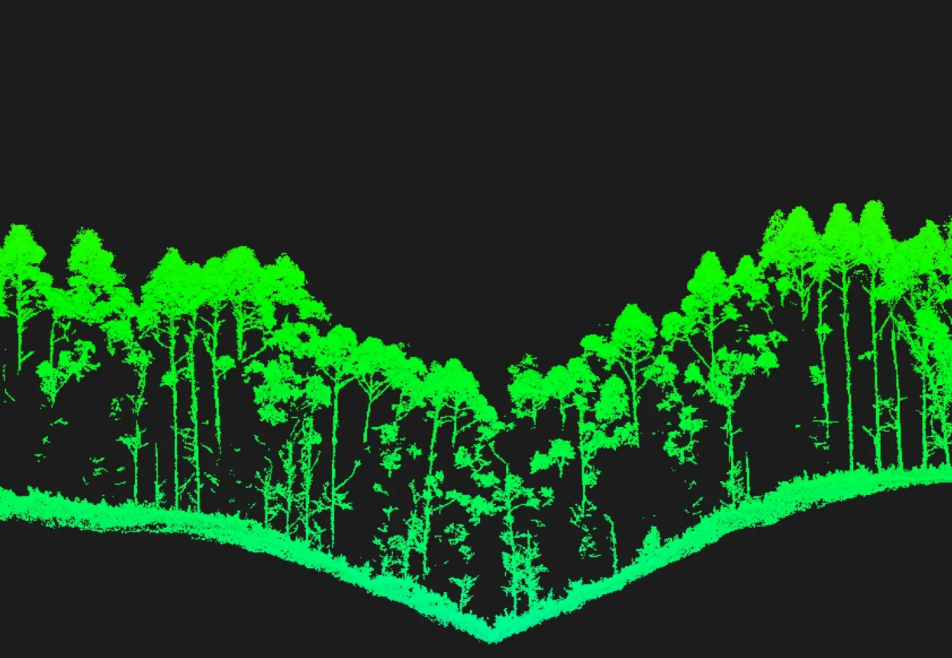
Forestry & Vegetation Mapping
Penetrate dense canopy using LiDAR to capture ground terrain, analyze forest structure, measure tree height, and estimate biomass for environmental and forestry management.
Compatible Platforms
DJI Matrice 350 RTK
Fully compatible for enterprise LiDAR mapping and surveying missions.
DJI Matrice 400
Optimized for next-generation heavy payload geospatial workflows.
End-to-End Workflow

If you have any questions, you are always welcome to contact us. We'll get back to you as soon as possible, within 24 hours on weekdays.
-
Shipping Information
Use this text to answer questions in as much detail as possible for your customers.
-
Customer Support
Use this text to answer questions in as much detail as possible for your customers.
-
FAQ’s
Use this text to answer questions in as much detail as possible for your customers.
-
Contact Us
Use this text to answer questions in as much detail as possible for your customers.